Inspections
In short: Landslip is the movement of soil or rock down a slope, often during or soon after heavy rain. On the Central Coast, Council's Development Control Plan 2022 rates a lot's landslip hazard from Category 1 to 4, using its slope, its geology and Council's own records. From Category 2 up, a development application needs a geotechnical report. Drainage, engineered retaining walls and deeper footings can reduce the risk.
Key takeaways
- Chapter 3.7 of the Central Coast DCP 2022 covers the whole council area and rates landslip hazard from Category 1 (low) to 4.
- A development application on a Category 2 or higher lot needs a geotechnical report; at Category 4 it must be a comprehensive one.
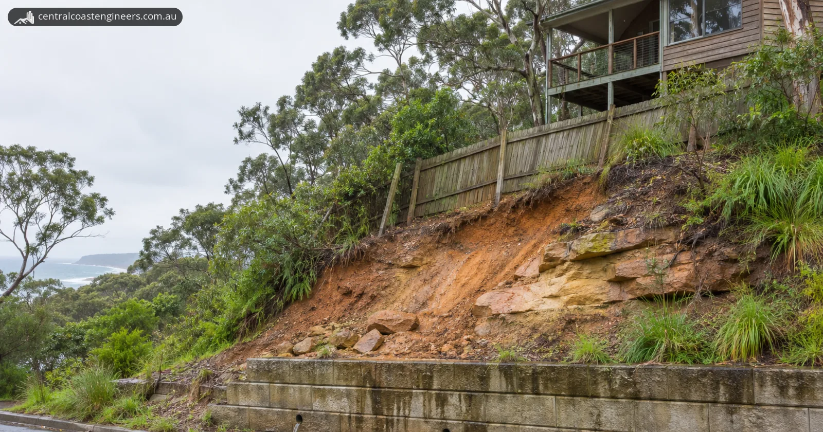
- Warning signs include new cracks or bulges in the ground, seepage where it is normally dry, leaning walls or fences, and sticking doors.
- Australian GeoGuide LR2 calls wetting up of the ground the single most important cause of landslides, which often follow heavy rain.
- Australian GeoGuide LR6 says retaining walls more than 900 mm high should be designed by a geotechnical practitioner or structural engineer.
Worried about a slope above or below your Central Coast home? Get a quote or call 02 4326 9026.
What is landslip?
Landslip, or a landslide, is any movement of a mass of rock, debris or earth down a slope. That is the definition in Australian GeoGuide LR2, a guide for property owners by the Australian Geomechanics Society, a technical society within Engineers Australia.
GeoGuide LR2 names wetting up of the ground, which may include a rise in the water table, as the single most important cause, so landslides often happen during or soon after heavy rain. Inappropriate development and exceptional weather can make them worse. Central Coast Council's disaster dashboard says that in NSW, landslides are generally caused when heavy rain saturates soil on a hillside.
How does Central Coast Council decide if a block is a landslip risk?
Central Coast Council decides landslip risk under Chapter 3.7 of its Development Control Plan 2022 (the DCP), which applies to all land in the council area. When it assesses a development application (DA), Chapter 3.7 says Council considers a site's slip potential from any historic information it holds, or by reference to its Landslip Hazard Assessment Matrix (Tables M1 and M2).
The matrix sorts land into four hazard categories:
| Hazard category | How the DCP describes it | Implications for development (DCP) | Geotechnical report with a DA |
|---|---|---|---|
| 1, Low | Not susceptible to significant landslip; instability not expected unless major site changes occur | Good engineering and conventional building practices usually sufficient | Not required by clause 3.7.1.2.2 |
| 2, Medium | Potential landslip hazard and possible soil creep; instability may occur during and after extreme climatic conditions | Restrictions on the nature and extent of development, especially earthworks, may be required | Required |
| 3, High | Susceptible to soil creep, landslip and rockfalls; seepage problems commonly occur | Significant restrictions, especially on earthworks and drainage, usually required | Required |
| 4, Immediate high | Evidence of active or past landslips, or slopes made potentially unstable by quarries, excavation, filling or erosion | Unsuitable for development unless localised areas can be re-rated to Category 3 or better | A comprehensive report is required |
Which category applies depends on the rock or soil under the block and on its slope. The matrix uses slope angles in degrees for each geological unit:
| Geology (DCP abbreviation) | Category 1 | Category 2 | Category 3 | Category 4 |
|---|---|---|---|---|
| Hawkesbury Sandstone (Rh) | 0° to 18°, in plateau areas | 18° to 23° | Over 23° to 33° | Over 33° |
| Terrigal Formation, sandstone sequences (Rnt-s) | 0° to 12½° | Over 12½° to 22° | Over 22° to 29° | Over 29° |
| Terrigal Formation, mudrock sequences (Rnt-m) | 0° to 10° | 10° to 18° | Over 18° to 24° | Over 24° |
| Patonga Claystone (Rnp) | Over 0° to 5° | Over 6° to 12° | Over 12° to 18° | Over 18°, and cliff or bluff areas |
Some bands also depend on distance from cliff lines. Sand, alluvium and estuarine deposits are rated by slope, depth to groundwater and distance from beaches and lake shores. Clause 3.7.1.2.1 encourages applicants to contact Council before lodging a DA where it is reasonable to think a site may have landslip issues.
How do you find out if your property is flagged for landslip?
Start with the property's Section 10.7 planning certificate. Central Coast Council says a property identified as flood prone gets a message on its Section 10.7 certificate, and that the same applies to other potential hazards, including landslip (Council). Council's disaster dashboard also advises asking your council, before buying land or building, about past landslide activity and known landslide risk assessments.
Coastal cliffs and bluffs have extra rules. Chapter 3.2 of the DCP identifies Geotechnical Hazard Zones on Council's coastal hazard mapping, where more detailed investigation is needed before Council assesses a development proposal. In the former Wyong area, new development with continuous footings, a slab (including a pool) or masonry in such a zone needs geotechnical assessments and a structural engineer's design. Our guide to coastal erosion and Central Coast homes covers Chapter 3.2's wider coastal hazard rules for beachfront homes.
What are the signs of slope movement?
The signs of slope movement are changes in the ground and in buildings that suggest the slope is shifting. Australian GeoGuide LR2 and Northern Beaches Council in Sydney list these:
- Open cracks, steps or scarps in the ground, often along the contours.
- Seepage, springs or saturated ground in places that are not normally wet.
- Bulging in the lower part of the slope, or hummocky ground.
- Trees, power poles, retaining walls or fences leaning, or fence lines that are offset.
- Decks or patios moving relative to the house, or doors and windows that stick.
- Tilted or cracked floors and foundations, and other cracked or distorted structures.
- Broken water lines or other underground services.
- Debris or fallen rocks at the foot of a cliff.
GeoGuide LR2 says these signs can appear on almost any slope, not only steep ones, and advises seeking a geotechnical practitioner's advice if you see any of them. Northern Beaches Council notes that a landslide can also happen without them.
What does a geotechnical assessment for a landslip site cover?
A geotechnical assessment for Central Coast Council covers the ground, the slope, the risk and the effect of the proposed work. Table 3 of DCP Chapter 3.7 sets the minimum content of the report:
| What the report covers | Details from Table 3 |
|---|---|
| Method | The assessment process adopted and the work done |
| The site | Vegetation, bedrock outcrops, seepage and groundwater, and existing development |
| Geology | The geological formations present, and the depth to weathered bedrock, especially within the building area |
| Slopes | Site slopes in degrees, the maximum slope, and areas of common slope |
| Drawings and boreholes | For a Class 1 report: a site plan, at least one geological section, and borehole logs to bedrock with at least one borehole in the building area |
| Risk | A risk assessment under the Australian Geomechanics Society guidelines, and a site classification under AS 2870 |
| Effects | The effect of the development on the stability of the site and adjoining land, and the stability of land above and below |
| Design advice | Enough information and recommendations for a structural or civil engineer to design for any instability, plus items the geotechnical engineer must inspect during construction |
The report gives the ground conditions and recommendations; a structural or civil engineer then designs the footings, walls and drainage to suit them.
How is landslip risk reduced?
Landslip risk can be reduced with drainage, engineered retaining walls and footings designed for the slope. Australian GeoGuide LR3 says that with appropriate engineering it is often possible to reduce the likelihood or consequences of a landslide, and that the design should be done by a geotechnical practitioner and will normally need council approval.
| Measure | What the Australian GeoGuides say |
|---|---|
| Stormwater and roof water | Pipe water from roofs and paved areas to a suitable discharge point instead of letting it soak in; avoid soak-away drainage (LR8) |
| Subsoil drains | Avoid drains that run along the contours; if needed, run them steeply downhill in a chevron or herringbone pattern (LR8) |
| Retaining walls | Engineer-designed walls with drains behind them to stop water pressure building up in the backfill (LR8). Design of walls over 900 mm should be by a geotechnical practitioner or structural engineer (LR6) |
| Footings | Take foundation loads below the level at which a landslide is likely to occur, preferably to rock. LR8 says this is probably not applicable to soil slopes |
| Loads on the slope | Keep fill and surface loads to a minimum, and use a lightweight, flexible structure (LR8) |
| Vegetation | Keep clearing of soil slopes to a reasonable minimum, as trees draw water out of the ground (LR8) |
GeoGuide LR8 says that where the ground slopes steeply down towards the high side of a retaining wall, the force on the wall can be two or more times that on level ground. GeoGuide LR6 warns against adding loads on the high side of a wall unless it was designed for them, more than light watering of plants behind it, and digging at its toe.
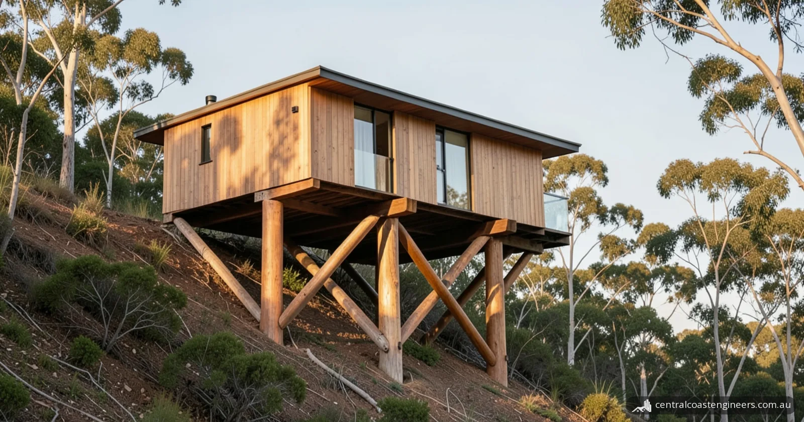
A lightweight house on a few deep footings is one way to follow this advice. Our guide to pole houses on sloping blocks explains how pole footings reach below the topsoil and compares them with cut and fill.
When to call a structural engineer
Call a structural engineer before you build or extend on a sloping Central Coast block, and when:
- a retaining wall leans, bulges, cracks or has blocked weep holes;
- cracks have opened in the house, the driveway or paths after heavy rain;
- you plan a cut, fill or retaining wall, or an addition on a slope;
- your geotechnical report recommends engineered footings, walls or drainage;
- Council or your certifier asks for a structural design that addresses a geotechnical hazard.
For an existing wall or house, our inspection reports include retaining wall and general building inspections. For new work, structural design and consultation covers retaining wall drawings, footings and stormwater design. To get a quote, send photos of the slope and any cracks, your plans, any geotechnical report, and your suburb.
Example from our projects
Our retaining wall design in Macmasters Beach shows core-filled block and sandstone walls up to 1.2 m, with drainage behind the walls and footings taken into stiff natural soil or rock.
Frequently asked questions
Who can prepare a geotechnical report for Central Coast Council?
Chapter 3.7 of the DCP defines a geotechnical engineer as a geotechnical engineer or geologist on the National Professional Engineers Register (Level 3) or a current member of the Australian Geomechanics Society. They also need at least five years' practice, experience with Sydney Basin geology such as the Terrigal Formation and Patonga Claystone, and professional indemnity cover of at least $10,000,000.
Can a landslide on my neighbour's land affect my property?
Yes. Australian GeoGuide LR2 says landslides do not respect property boundaries: they can run out from above, regress from below or expand sideways, so a hazard affecting your property may sit on someone else's land.
What should I do if I think a landslide is about to happen?
Northern Beaches Council, another NSW council, says to call NSW Police on 000 if you suspect imminent danger, tell affected neighbours and move to a safe location. NSW Police is the lead agency for landslide emergencies.
How steep is a steep block?
Australian GeoGuide LR2 describes slopes of 0 to 10 degrees as gentle, 10 to 18 degrees as moderate, 18 to 27 degrees as steep and 27 to 45 degrees as very steep. A steep slope is up to about 1 on 2.
Sources
- Central Coast Council: Development Control Plan 2022, Chapter 3.7 Geotechnical Requirements
- Central Coast Council: Development Control Plan 2022, Chapter 3.2 Coastal Hazard Management
- Central Coast Council: Planning and development within flood zones (Section 10.7 certificate hazard notes)
- Central Coast Council Disaster Dashboard: Landslide
- Northern Beaches Council: Landslide
- Australian Geomechanics Society: Australian GeoGuide LR2, Landslides (2007)
- Australian Geomechanics Society: Australian GeoGuide LR3, Landslides in Soil (2007)
- Australian Geomechanics Society: Australian GeoGuide LR6, Retaining Walls (2007)
- Australian Geomechanics Society: Australian GeoGuide LR8, Hillside Construction Practice (2007)